Unusually heavy snow melt, rain storms prompt water releases into normally dry portions of Salt River
Flooding could intensify after recent winter storms
Courtesy of u/Thinkbiz1 (Reddit)
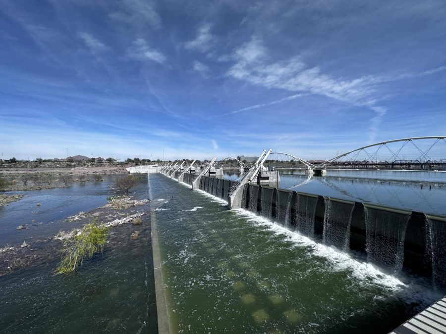
Water running out of Tempe Town Lake
March 16, 2023
Valley residents may have noticed the usually dry stretch of the Salt River downstream from Granite Reef dam has come to life, as the Salt River Project (SRP) will continue to monitor and release water from upstream reservoirs nearing capacity.
This is in anticipation of the large snow melt that is already affecting our state. This season’s wet winter brought the second largest snowpack Arizona has seen in the last 30 years.
Beginning in early March, SRP started a low-level water release (500-1,000 cubic feet per second (cfs) stemming from the Bartlett Dam and Verde River Reservoir system. This reservoir system leads to the Salt River and its extensive irrigation canal network, some of which are the same canal paths created by the ancestors of the present-day Salt River Pima-Maricopa Indian and Gila River Indian communities.
The Verde River reservoir system is replenished annually by a 13,000-square-mile watershed that encompasses a large portion of Northern Arizona. This includes many Northern Arizona cities that were hit hard by snowstorms this year, such as Flagstaff, Sedona, Prescott and Payson. The snowmelt flows into the Verde River systems and are regulated by a group of dams.
East Valley residents may be more familiar with the Granite Reef Dam which diverts nearly all water from the Salt River into the canals, which serve metropolitan Phoenix with irrigation and drinking water.
With the Spring season here and temperatures beginning to rise, all that snow is melting fast.
Northeast Valley News spoke with SRP meteorologist, Dr. Bo Svoma, about how SRP is handling this year’s wet winter and how it may affect Arizona residents.
Dr. Svoma emphasized that the low-level release is a preemptive measure in order to “make room for the snowmelt” and that the water is not necessarily being wasted, but instead will contribute to canals and city treatment plants.
SRP works closely with law enforcement and city officials in order to ensure residents near the river stay safe. Valley residents should keep an ear out for traffic updates since the Salt River goes right through Metro-Phoenix.
Most major roads have a bridged crossing over the river but some roads have been forced to close due to flooding. Most notably, McKellips Rd. in Mesa and 67th Ave. in the West Valley.
Generally, Tempe Town Lake acts as a buffer, protecting areas further south from flooding, but the shallow reservoir hasn’t been able to accommodate the prolonged releases of water from Granite Reef Dam.
“Any unbridged crossings are gonna be at risk of closure,” Svoma said.
Svoma also discussed future plans to modify Bartlett Damn in order to store a larger amount of water in the Verde reservoir systems during “wet winters like these.”
Valley residents should expect the flooding and road closures to possibly intensify and broaden due to this week’s rain storms. At time of publishing, the Verde river just south of Camp Verde, Ariz. Was flowing at a rate of 28,000 cfs, down from a peak of around 41,000 cfs.
Much of that water will ultimately make its way into the lower Salt River at Phon D Sutton, just above Granite Reef Dam.
For perspective, peak summer flows on the Lower Salt River generally fluctuate between 750 – 1,500 cfs.
For more information on road closures one can refer to the city of Phoenix’s Street Transportation Department.
Update: March 21, 2023
The U.S. Forest Service, who manages the Tonto National Forest, has temporarily closed three recreation areas on the Lower Salt River. Extremely high inflows from the Verde River have prompted the closures, presumably in the name of public safety, of Coon Bluff, Phon D Sutton and Granite Reef recreation areas. Coon Bluff lies roughly a mile and a half upstream of Phon D Sutton, where the Verde and Salt Rivers converge. Massive inflows from the Verde River have significantly raised water levels and have ultimately created dangerous situations for river users.


